Commons is a freely licensed media file repository. You can help.
This image was uploaded in the JPEG format even though it consists of non-photographic data. This information could be stored more efficiently or accurately in the PNG or SVG format. If possible, please upload a PNG or SVG version of this image without compression artifacts, derived from a non-JPEG source (or with existing artifacts removed). After doing so, please tag the JPEG version with {{Superseded|NewImage.ext}} and remove this tag. This tag should not be applied to photographs or scans. If this image is a diagram or other image suitable for vectorisation, please tag this image with {{Convert to SVG}} instead of {{BadJPEG}}. If not suitable for vectorisation, use {{Convert to PNG}}. For more information, see {{BadJPEG}}.
Summary
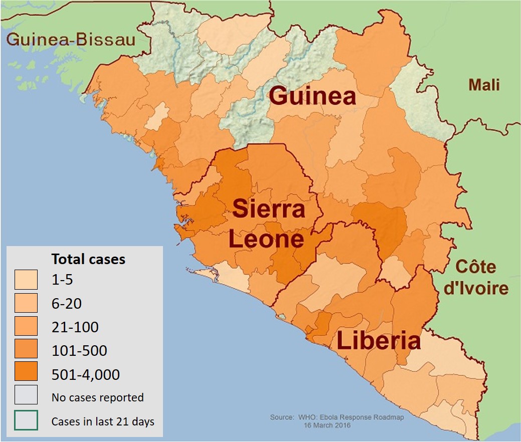
Description2014 West Africa Ebola virus outbreak situation map.jpg
English: This is a map of the distribution of the Ebola virus epidemic in Guinea, Liberia, and Sierra Leone as of 17 December 2014.


